
The essential:
- Meteorologists recognise 10 main types of clouds, called genera, sorted into low, middle and high levels.
- Low clouds usually have bases below about 2,000 m, while high clouds sit above about 5,000 m and are made of ice.
- Cumulus, stratus and cirrus were named by the English chemist Luke Howard, who presented his scheme in December 1802.
- A typical cloud droplet is about 0.02 mm across, roughly 100 times smaller than an average raindrop.
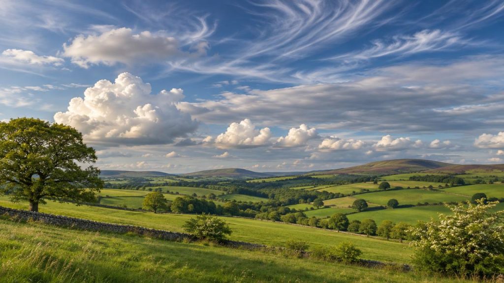
There are 10 main types of clouds, and once you know them the British sky turns from a grey blur into a running commentary on the weather. That flat white sheet at breakfast, the cotton-wool puffs at lunchtime and the towering anvil at teatime are three different chapters of the same story, written in water droplets and ice crystals.
As a former museum science communicator, I have watched plenty of visitors light up when they realise cloud spotting needs no equipment at all, only a window and a few names. This guide covers how clouds form, the three basic shapes, each height level, the clouds that warn of rain, a few rare oddities, and a simple routine to start reading the sky yourself.
📋 Table of contents
- What are the main types of clouds?
- How do clouds form?
- Cumulus, stratus and cirrus: where do the names come from?
- Which low types of clouds will you see most often in the UK?
- What are the middle and high cloud types called?
- Which clouds predict rain?
- Are there rare or new types of clouds?
- Our take: the easiest way to start reading the sky
- FAQ
What are the main types of clouds?
The World Meteorological Organization recognises 10 main types of clouds, called genera. They are grouped by the height of their base into low, middle and high clouds, with cumulonimbus spanning several levels. The official reference is the International Cloud Atlas, published by the World Meteorological Organization and used by the Met Office and every national weather service. It sorts clouds rather like a naturalist sorts animals: 10 genera, which are then split into species and varieties, giving around 100 possible combinations. For everyday sky watching, the 10 genera are all you need.
The quickest way to learn them is by height. In temperate latitudes such as the UK:
- Low clouds usually have a base at or below about 2,000 m: stratus, stratocumulus and cumulus.
- Middle clouds usually sit between about 2,000 and 7,000 m: altocumulus, altostratus and nimbostratus.
- High clouds have a base above about 5,000 m: cirrus, cirrocumulus and cirrostratus.
Cumulonimbus is the odd one out. Its base is low, but its top can climb to the ceiling of the weather layer of the atmosphere, so it occupies all three levels at once. The table below gives you a cheat sheet you can keep by the window.
| Level | Cloud types | Typical base height | What they look like |
|---|---|---|---|
| Low | Stratus, stratocumulus, cumulus | Surface to about 2,000 m | Grey sheets, lumpy layers, white puffs |
| Middle | Altocumulus, altostratus, nimbostratus | About 2,000 to 7,000 m | Small rolls, thin grey veil, thick rain layer |
| High | Cirrus, cirrocumulus, cirrostratus | Above about 5,000 m | Wispy streaks, tiny ripples, milky haze |
| Several levels | Cumulonimbus | Low base, very tall top | Towering mass, often with a flat anvil |
⭐ Key takeaway
Learn the prefixes and you can decode almost every cloud name: cirro means high, alto means middle, nimbo or nimbus means rain-bearing, cumulus means heaped and stratus means layered.
How do clouds form?
Clouds form when moist air rises and cools until its water vapour condenses onto tiny airborne particles, creating billions of droplets or ice crystals small enough to stay suspended in the air. Air always contains some invisible water vapour. Warm air can hold more of it than cold air, so when a parcel of air rises and expands, it cools, and at a certain point it can no longer hold all that vapour. The excess condenses into liquid. It does not do so on its own, though: each droplet needs a seed, a speck of dust, sea salt, pollen or smoke called a condensation nucleus.
There are a few main ways air gets lifted high enough to make cloud:
- Convection: the sun heats the ground, warm bubbles of air rise like a hot-air balloon and build cumulus.
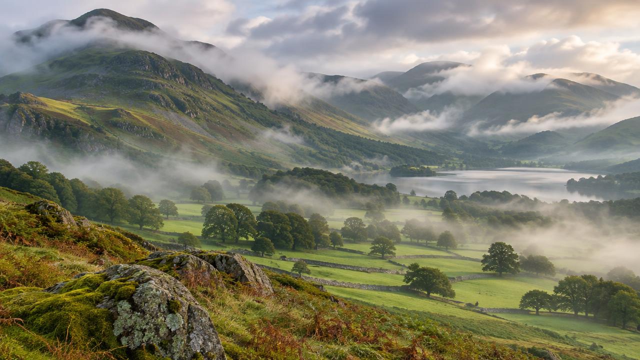
- Hills and mountains: wind forced up a slope cools and drops cloud on the summit, which is why the Lake District and Snowdonia are so often capped in grey.
- Weather fronts: warm air slides up over cold air along a front, producing wide layers of stratus-type cloud.
The droplets are tiny. A typical cloud droplet measures about 0.02 mm across, roughly 100 times smaller than an average raindrop of about 2 mm. Since volume scales with the cube of diameter, it takes in the order of a million cloud droplets to build one raindrop, which explains why not every cloud produces rain.
Cumulus, stratus and cirrus: where do the names come from?
Cumulus (heap), stratus (layer) and cirrus (curl of hair) are Latin names chosen by the English chemist and amateur meteorologist Luke Howard, who presented his classification in London in December 1802. Before Howard, people described clouds with local words and weather sayings, and no two observers used the same vocabulary. Howard, a Quaker chemist with a passion for the sky, borrowed the approach of the botanist Carl Linnaeus and gave clouds Latin names based on their shape. He read his paper, On the Modifications of Clouds, to a London scientific club called the Askesian Society in December 1802, and it was printed in the Philosophical Magazine in 1803.
His three basic forms are still the backbone of every cloud chart:
- Cumulus: heaped, rounded clouds with flat bases, built by rising air.
- Stratus: flat, horizontal layers, formed when a broad sheet of air cools gently.
- Cirrus: thin, fibrous streaks of ice high in the sky.
Howard also coined combinations such as cirro-cumulus and cirro-stratus, plus nimbus for a rain cloud. The modern system has grown to 10 genera, but almost every name is still built from his building blocks. When you say cumulus stratus cirrus out loud, you are speaking an early 19th-century scientific language that has survived more than two centuries of use.
💡 Did you know?
Luke Howard’s cloud names impressed the German poet Goethe so much that he wrote verses in his honour. A chemist’s lecture to a small London club ended up shaping how the whole world talks about the sky.
Which low types of clouds will you see most often in the UK?
Stratocumulus, stratus and cumulus dominate British skies, and stratocumulus is the most common cloud on Earth. Cumulonimbus, the thunderstorm cloud, also starts low but grows far taller than any other type. Low clouds are the ones that decide whether your day feels bright or gloomy, and the British Isles see a lot of them.
- Stratocumulus: grey or whitish patches or rolls, often joined into a lumpy blanket with gaps of blue. It is the classic “grey but dry” sky and rarely gives more than light drizzle.
- Stratus: a featureless grey layer, sometimes low enough to hide the tops of buildings. When it touches the ground, we call it fog. It can produce drizzle but not heavy rain.
- Cumulus: the white, cauliflower-topped puffs of a sunny afternoon. Small, flat ones (fair-weather cumulus) are harmless; if they keep growing upwards through the day, they are worth watching.
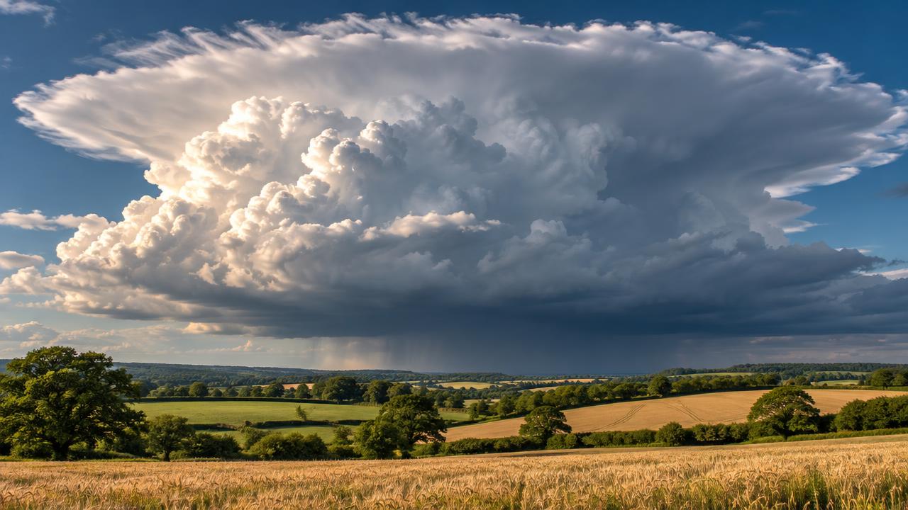
- Cumulonimbus: a cumulus that kept going. Its top can tower more than 10 km high, spreading into a flat anvil of ice at the top. It brings heavy showers, hail, lightning and thunder.
A handy rule: if you can see clear outlines and bright sunlit edges, you are probably looking at a cumulus-type cloud; if the sky looks like a uniform lid, think stratus.
What are the middle and high cloud types called?
The middle clouds are altocumulus, altostratus and nimbostratus. The high clouds, made almost entirely of ice crystals, are cirrus, cirrocumulus and cirrostratus. Middle-level clouds are made of water droplets, ice or a mix of both:
- Altocumulus: rows or patches of small rounded clouds, often with shading on their undersides. A full sheet of it gives the dappled pattern known as a mackerel sky.
- Altostratus: a thin grey or bluish veil through which the sun looks like it is shining through frosted glass, without casting sharp shadows.
- Nimbostratus: a thick, dark, shapeless layer that produces long spells of steady rain or snow. It is classed as a middle cloud, though its base often sags close to the ground.
High clouds are thin because there is little moisture that far up, and it is far too cold for liquid water to last:
- Cirrus: delicate white streaks or hooks, nicknamed mares’ tails.
- Cirrocumulus: tiny white ripples or grains, like sand on a beach, and rarer than cirrus.
- Cirrostratus: a milky, almost transparent sheet. Its ice crystals bend sunlight or moonlight into a halo, a bright ring around the sun or moon.
If you notice a halo, look again in a few hours: cirrostratus thickening into altostratus is one of the textbook signs that a warm front is on its way.
Which clouds predict rain?
Nimbostratus and cumulonimbus are the clouds that actually produce rain. A sequence of cirrus, then cirrostratus, then thickening altostratus often warns of rain arriving within the next day. Some clouds are rain makers, others are messengers. The rain makers are easy: nimbostratus brings long, steady rain, and cumulonimbus brings short, heavy showers, sometimes with hail and thunder. Thick stratus and stratocumulus can add drizzle.
The messengers are more interesting, because they let you look ahead. When a warm front approaches the UK from the Atlantic, the cloud typically arrives in a recognisable order:
- cirrus streaks spreading across a blue sky;
- a milky cirrostratus sheet, often with a halo;
- altostratus, with the sun fading to a watery disc;
- finally low nimbostratus and steady rain.
Sailors summed this up in the old saying “mackerel sky and mares’ tails make lofty ships carry low sails”. On summer days, watch cumulus instead: if the puffs are tall by late morning, showers are likely by afternoon.
Cloud reading pairs nicely with a pressure instrument. A traditional Goethe barometer shows falling air pressure, a genuine sign of unsettled weather. Decorative crystal glasses like the Storm Glass Weather Predictor are a different story: their crystals respond mainly to temperature, which our guide on how the storm glass barometer works explains in detail. Enjoy them as a beautiful experiment, and trust the clouds for the forecast.

🛍️ Our pick
Storm Glass Weather Predictor
A sealed glass of camphor solution whose crystals change with the weather: a Victorian forecasting curio to pair with your own cloud watching.
£33.49 · ★ 290 sold
Discover →Are there rare or new types of clouds?
Yes. The 2017 edition of the International Cloud Atlas added asperitas, a wave-like underside, and volutus, the roll cloud, and officially recognised aircraft contrails as homogenitus, a cloud made by human activity. The cloud catalogue is not frozen. On 23 March 2017, World Meteorological Day, the WMO launched an updated online International Cloud Atlas after nearly three years of work by a specialist team. The 10 genera stayed the same, but several new names arrived:
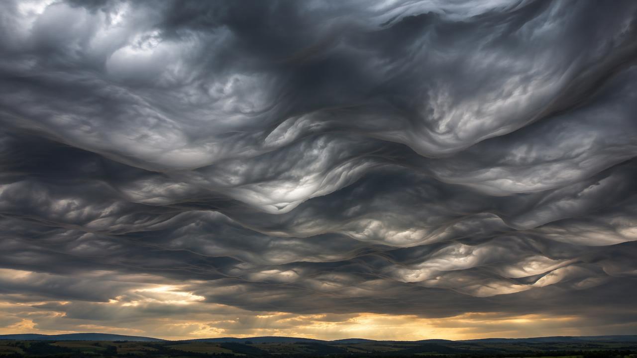
- Asperitas: a dramatic, rough underside that looks like a choppy sea seen from below. The push to recognise it came largely from amateur photographers in the Cloud Appreciation Society.
- Volutus: a long, horizontal roll cloud, detached from other clouds and seeming to tumble along.
- Homogenitus: clouds formed by human activity, the best known being aircraft contrails. A contrail that spreads and lingers is a sign of moist air high up.
Other rarities are worth a trip outside. Noctilucent clouds glow electric blue on summer nights in northern Britain; they float in the mesosphere, around 80 km up, far above every other type of cloud. Mammatus, the pouch-like bulges under a storm anvil, are a supplementary feature rather than a genus.
If you already enjoy looking up at night, cloud spotting is the daytime twin of star hopping: the same habit that helps you find the North Star will make you notice when an unusual cloud appears.
Our take: the easiest way to start reading the sky
Start with height and shape, not with the full list of names. Decide whether a cloud is low, middle or high, then whether it is heaped or layered, and you will correctly name most types of clouds within a week. In workshops, the question that comes up most is “how do I remember all ten?” The honest answer is that you do not need to memorise them in one go. Try this routine instead:
- Look at the same patch of sky every morning, from the same window, for a week.
- Ask two questions: how high is it, and is it heaped or layered? That alone narrows things down to one or two genera.
- Check the edges: crisp edges mean liquid droplets, soft, fibrous edges mean ice.
- Note what happens next: write down the cloud and the weather six hours later. Within a fortnight you will see the patterns yourself.
A weather corner at home makes the habit stick. A Crystal Storm Glass Barometer or a cloud-shaped crystal glass on the windowsill is a lovely prompt to glance up at the sky, and you will find more instruments in our storm glass collection and the wider science decor range. Once you can name the clouds, test yourself with our climate and weather quiz. Cloud spotting is one of the rare sciences that costs nothing, works from any window and gets better every single day you practise.

🛍️ Our pick
Crystal Storm Glass Barometer
An elegant storm glass whose crystals shift from clear to feathery as conditions change: a striking way to follow the weather at home.
£28.49 · ★ 327 sold
Discover →FAQ
Sources
- World Meteorological Organization, International Cloud Atlas (2017 online edition)
- Met Office, cloud classification and identification guidance
- Royal Meteorological Society, International Cloud Atlas and new cloud classifications
- Luke Howard, On the Modifications of Clouds, Philosophical Magazine (1803)
- University of Manchester, Centre for Atmospheric Science, cloud classification